File:Monts Jura (Carte topographique).png
From Wikimini Stock
Size of this preview: 171 × 239 pixels. Other resolutions: 429 × 600 pixels | 800 × 1,118 pixels.
Original file (800 × 1,118 pixels, file size: 1.01 MB, MIME type: image/png)
Summary
| ⧼wm-license-information-description⧽ |
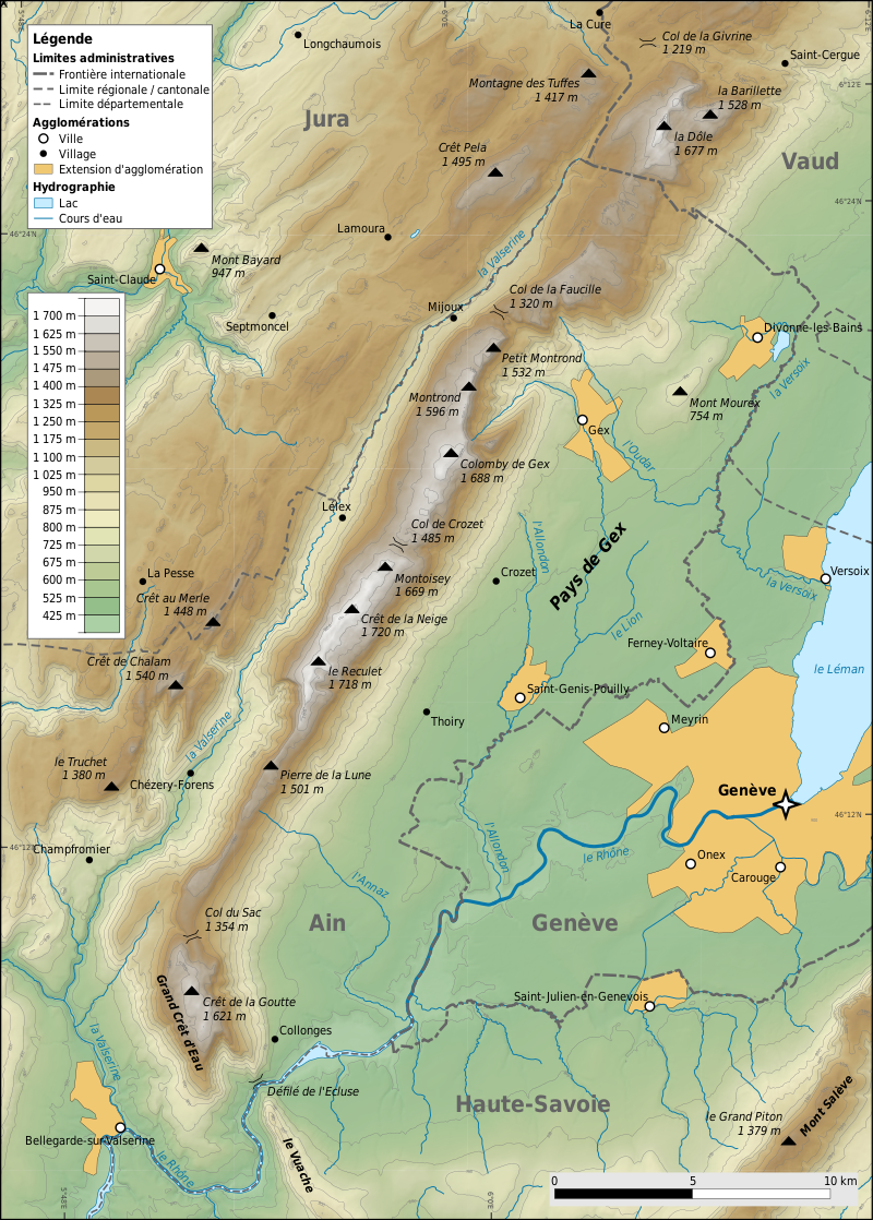
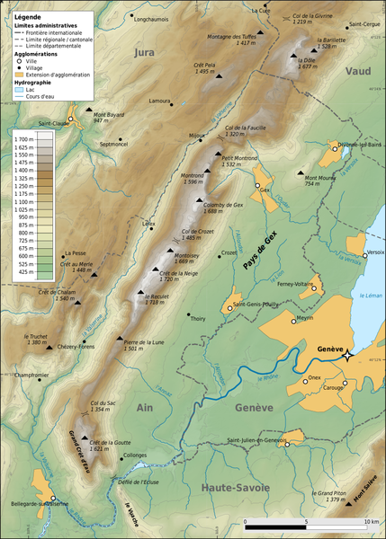
Français : Carte topographique de Monts Jura.
|
| ⧼wm-license-information-source⧽ | https://fr.wikipedia.org/wiki/Monts_Jura |
| ⧼wm-license-information-author⧽ | Géodigital |
Licensing
| |
The person who uploaded this file (see below) certifies that he/she has verified the legal terms of use of this image/photo (copyright status) before adding it to Wikimini.
Specifically, he/she warrants that he/she has been given written permission by the author (copyright holder) to publish and use this image/photo on Wikimini. Any other use is subject to prior permission from the author/copyright holder.
|
File history
Click on a date/time to view the file as it appeared at that time.
| Date/Time | Thumbnail | Dimensions | User | Comment | |
|---|---|---|---|---|---|
| current | 16:39, 22 January 2023 | | 800 × 1,118 (1.01 MB) | KatchiCraft (talk | contribs) | {{Information |Description = {{fr| Carte topographique de Monts Jura. }} |Source = https://fr.wikipedia.org/wiki/Monts_Jura |Author = Géodigital }} |
- You cannot overwrite this file.
File usage
There are no pages on the Stock that use this file.
Check on:
- Encyclopedias
- Wikimini ES (Wikimini en español)
- Wikimini FR (Wikimini en français)
- Wikimini SV (Wikimini på svenska)
.png#filelinks)
.png#filelinks)
.png#filelinks)
- Other
.png#filelinks)
.png&oldid=159157)
.png)
.png&action=edit&redlink=1)
.png&action=edit)
.png&action=history)
.png)
.png)
.png&printable=yes)
.png&oldid=159157)
.png&action=info)