File:Localisation Terre de Feu (Argentine-Chili).png
From Wikimini Stock

Size of this preview: 320 × 201 pixels. Other resolutions: 800 × 501 pixels | 3,894 × 2,441 pixels.
Original file (3,894 × 2,441 pixels, file size: 639 KB, MIME type: image/png)
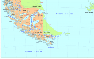
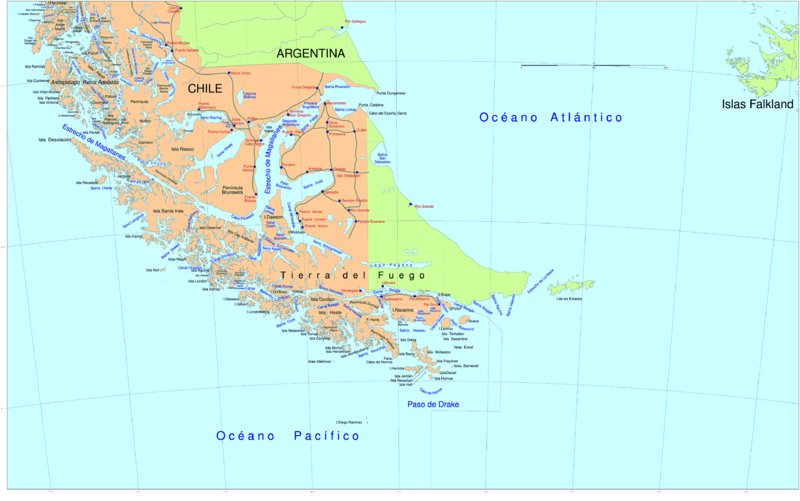
Localisation de la Terre de Feu et du détroit de Magellan à l'ouest.
Source : [1]
File history
Click on a date/time to view the file as it appeared at that time.
| Date/Time | Thumbnail | Dimensions | User | Comment | |
|---|---|---|---|---|---|
| current | 13:41, 20 July 2012 | | 3,894 × 2,441 (639 KB) | Jereemy (talk | contribs) | Localisation de la Terre de Feu et du détroit de Magellan à l'ouest. Source : [http://fr.wikipedia.org/wiki/Fichier:South_America_southern_tip_pol.png] |
- You cannot overwrite this file.
File usage
There are no pages on the Stock that use this file.
Check on:
- Encyclopedias
- Wikimini ES (Wikimini en español)
- Wikimini FR (Wikimini en français)
- Wikimini SV (Wikimini på svenska)
.png#filelinks)
.png#filelinks)
.png#filelinks)
- Other
.png#filelinks)
.png&oldid=119830)
.png)
.png&action=edit&redlink=1)
.png&action=edit)
.png&action=history)
.png)
.png)
.png&printable=yes)
.png&oldid=119830)
.png&action=info)