File:Egypte carte.png
From Wikimini Stock

Size of this preview: 223 × 239 pixels. Other resolution: 342 × 367 pixels.
Original file (342 × 367 pixels, file size: 40 KB, MIME type: image/png)
Description
| ⧼wm-license-information-description⧽ |
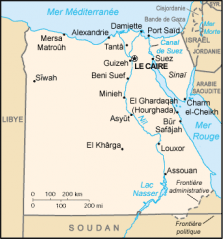
Français : Situation géographique du Caire en Egypte
|
| ⧼wm-license-information-source⧽ | http://commons.wikimedia.org/wiki/File:Egypte_carte.png?uselang=fr#globalusage |
| ⧼wm-license-information-author⧽ | CIA World Factbook |
Licensing:
| |
The person who uploaded this file (see below) certifies that he/she has verified the legal terms of use of this image/photo (copyright status) before adding it to Wikimini.
Specifically, use of this image/photo is permitted because it is in the public domain, either due to expired copyright or explicit release to the public domain by the copyright holder.
|
File history
Click on a date/time to view the file as it appeared at that time.
| Date/Time | Thumbnail | Dimensions | User | Comment | |
|---|---|---|---|---|---|
| current | 15:36, 19 June 2014 | | 342 × 367 (40 KB) | Groupe4 (talk | contribs) | {{Information |Description = {{fr| Situation géographique du Caire en Egypte }} |Source = http://commons.wikimedia.org/wiki/File:Egypte_carte.png?uselang=fr#globalusage |Author = CIA World Factbook }} |
- You cannot overwrite this file.
File usage
There are no pages on the Stock that use this file.
Check on:
- Encyclopedias
- Wikimini ES (Wikimini en español)
- Wikimini FR (Wikimini en français)
- Wikimini SV (Wikimini på svenska)
- Other