File:Carte Mésopotamie.png
From Wikimini Stock
Size of this preview: 320 × 226 pixels. Other resolution: 800 × 565 pixels.
Original file (800 × 565 pixels, file size: 663 KB, MIME type: image/png)
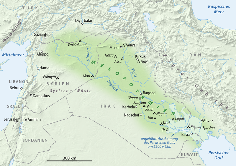
Carte montrant l'emplacement de la Mésopotamie (en vert) par rapport à l'organisation des frontières actuelles.
Source : http://commons.wikimedia.org/wiki/File:Karte_Mesopotamien.png?uselang=de
File history
Click on a date/time to view the file as it appeared at that time.
| Date/Time | Thumbnail | Dimensions | User | Comment | |
|---|---|---|---|---|---|
| current | 21:53, 25 May 2010 | | 800 × 565 (663 KB) | Lorangeo (talk | contribs) | Carte montrant l'emplacement de la Mésopotamie (en vert) par rapport à l'organisation des frontières actuelles. Source : http://commons.wikimedia.org/wiki/File:Karte_Mesopotamien.png?uselang=de |
- You cannot overwrite this file.
File usage
There are no pages on the Stock that use this file.
Check on:
- Encyclopedias
- Wikimini ES (Wikimini en español)
- Wikimini FR (Wikimini en français)
- Wikimini SV (Wikimini på svenska)
- Other