File:Carte-Kerguelen.png
From Wikimini Stock

Size of this preview: 230 × 239 pixels. Other resolutions: 576 × 600 pixels | 1,840 × 1,915 pixels.
Original file (1,840 × 1,915 pixels, file size: 2.08 MB, MIME type: image/png)
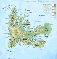
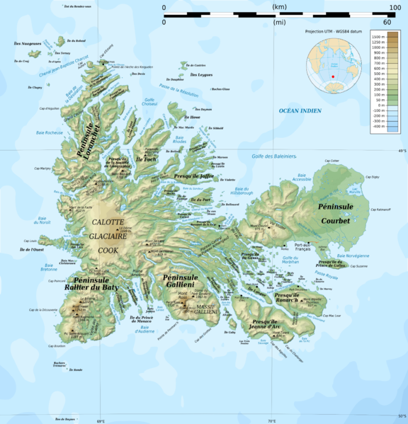
Carte détaillé de l'archipel des îles Kerguelen.
Source : [1]
File history
Click on a date/time to view the file as it appeared at that time.
| Date/Time | Thumbnail | Dimensions | User | Comment | |
|---|---|---|---|---|---|
| current | 17:03, 22 February 2012 | | 1,840 × 1,915 (2.08 MB) | Jereemy (talk | contribs) | Carte détaillé de l'archipel des îles Kerguelen. Source : [http://fr.wikipedia.org/wiki/Fichier:Kerguelen_topographic_map-fr.png] |
- You cannot overwrite this file.
File usage
There are no pages on the Stock that use this file.
Check on:
- Encyclopedias
- Wikimini ES (Wikimini en español)
- Wikimini FR (Wikimini en français)
- Wikimini SV (Wikimini på svenska)
- Other